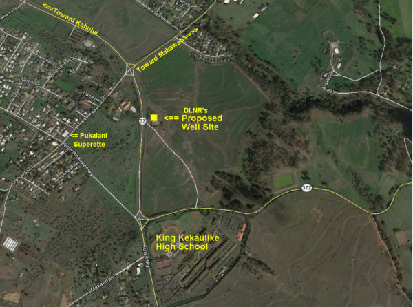
The preliminary document from Geometrician Associates, LLC and a map locating the proposed Pukalani well-site.
[gview file=”http://Maui-Tomorrow.org/wp-content/uploads/2013/07/Early-Consultation-for-EA-Proposed-DLNR-Pukalani-Reservoir-Well.pdf”]
The proposed well would be developed by the State’s DLNR and the water would be put into the County’s Department of Water Supply’s distribution system. In the attached document there are several references to a “Pukalani Reservoir”; that is actually a reference to the large water tank on the east side of the Pukalani bypass at an elevation of about 1,670’.
You can email your suggestions on what the Environmental Assessment should be considering to Ron Terry at rterry@hawaii.rr.com.


